Viewing tracks in Google Earth
In order to view KML or KMZ files you need to have the Google Earth application installed on your computer.
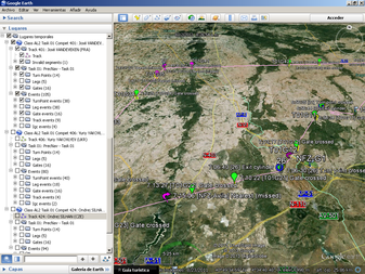
You can click on any KML link in the Track Analysis page. The file will be downloaded and Google Earth will open it and display a new folder in the Temporary Places tree named like: Class CCC Task 00 Compet 000: Competitor's Name (Country). You can select which items to display from the new file divided in three main groups. You can navigate through them activating or deactivating their display with the check boxes. And you can double click on one to see it on the map.
|
 |
 |
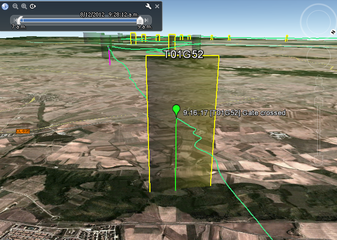 |
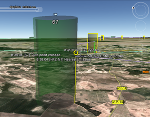
| Turn point | Gate |
Look at the Slider at the top left corner of the image. This lets you select a time window for timed events. Make sure the two cursors are expanded to both ends so that all available events are presented.
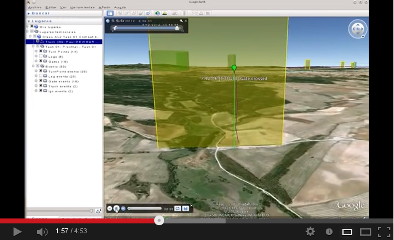
If you want to "fly the task" from the pilot's point of view, you can expand the track folder, select the track and click on the Play Tour button at the bottom of the Places block. For a better experience you may want to adjust the "Touring" settings. Go to Tools -> Options -> Touring and adjust it something like this:
- Camera Tilt Angle: 77degrees
- Camera Range: 150 metres
- Speed: 150
Watch the video to see how it looks like.